Infrastructure
Enhance decision-making for roads, bridges, dams, and urban infrastructure by creating designs, simulating scenarios, and leveraging real-time geospatial insights. This data-driven approach improves planning, maintenance, and resource optimization while refining the design and construction of critical infrastructure. Simulations help identify potential issues, optimize designs for resilience, and improve efficiency in construction and repairs. Ultimately, this leads to more informed, proactive decisions for long-term safety and sustainability.
Solutions for Infrastructure

Optimize Bridge and Dam Design with Advanced Simulation
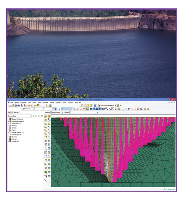
Effective bridge and dam design requires understanding how structures interact with various environmental factors, such as load, weather, and seismic activity. SIMULIA provides advanced simulation tools to test the structural integrity and performance of bridges and dams under different conditions. Using finite element analysis (FEA), SIMULIA helps engineers assess the behavior of the structure over time, ensuring safety, durability, and performance while minimizing the risk of failure during operation.

Enhance Infrastructure Planning with Geospatial Data and Mapping
Successful infrastructure planning relies on accurate and up-to-date geospatial data to make informed decisions. Esri ArcGIS offers comprehensive tools for mapping, analyzing, and visualizing infrastructure projects. By integrating satellite imagery, terrain data, and 3D models, planners can assess site conditions, plan construction projects, and manage ongoing infrastructure projects efficiently. ArcGIS helps optimize site selection, resource allocation, and project timelines, ensuring smoother execution and better outcomes for infrastructure projects.

Soil Simulation for Bridge and Dam Foundations
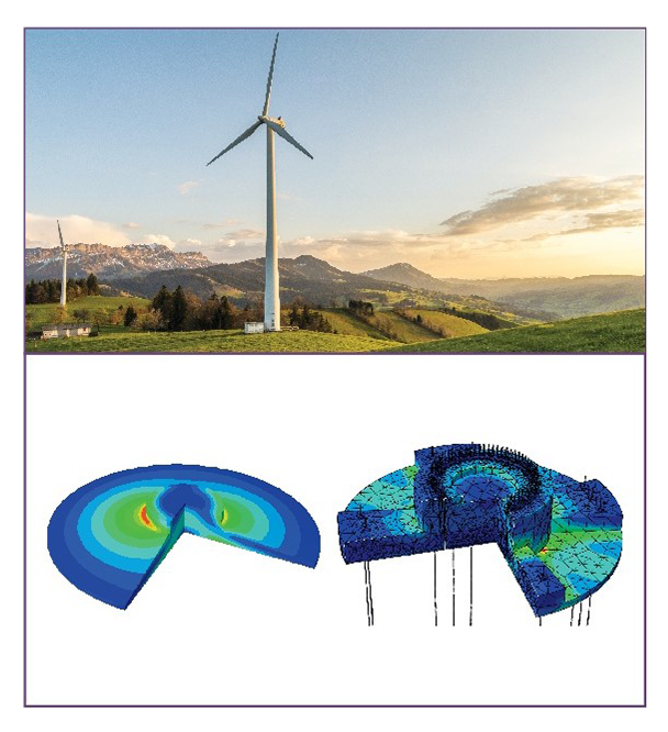
Understanding soil behaviour is critical to the design and stability of bridge and dam foundations. SIMULIA offers advanced soil-structure interaction (SSI) simulations, helping engineers analyze how soil conditions affect the foundation's performance. By simulating soil deformation, load distribution, and foundation behaviour, engineers can make informed decisions about foundation design, ensuring stability and safety in challenging environmental conditions.

Products

CATIA
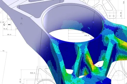
Create high-performance solutions for infrastructure projects like dam, bridges, wind turbines and energy


SIMULIA
Optimize performance, safety, and reliability of infrastructure with advanced simulations

Esri ArcGIS
Transform infrastructure, energy, and utility management with geospatial intelligence and real-time analytics
Trends

Efficient Space Management in Airports and Ports with ArcGIS
Effective space management is crucial in airports and ports to ensure smooth operations, maximize capacity, and improve passenger and cargo flow. However, these facilities often struggle with challenges like overcrowding, inefficient resource allocation, and the complexity of managing vast, dynamic environments. ArcGIS, a leading Geographic Information System (GIS) platform, helps address these issues by providing comprehensive spatial analysis and real-time data visualization tools. With ArcGIS, airport and port authorities can efficiently map, track, and manage space usage, from terminals and runways to loading docks and storage areas. This enables better planning, improved resource allocation, and quicker responses to bottlenecks or disruptions, ultimately enhancing operational efficiency, customer experience, and facility capacity

Enhance Infrastructure Operations with GIS for Streamlined Workflow and Resource Allocation
Efficient infrastructure operations are critical for the smooth functioning of cities, transportation networks, and utility services. However, infrastructure management faces challenges such as resource misallocation, delayed project timelines, and difficulty in coordinating complex workflows across multiple teams and locations. ArcGIS

Optimize Infrastructure Asset Management with GIS for Real-Time Data and Tracking
Effective asset management is crucial in the infrastructure industry, where managing a wide range of assets—from roads and bridges to utilities and buildings—can be complex and resource-intensive. Key challenges include maintaining up-to-date data, tracking asset conditions, and coordinating maintenance activities across vast areas. ArcGIS, a leading Geographic Information System (GIS) platform, addresses these challenges by offering real-time data integration and tracking capabilities. With ArcGIS, infrastructur
Latest Blog Posts
Discover our most recent posts across all industries, branchs and topics.
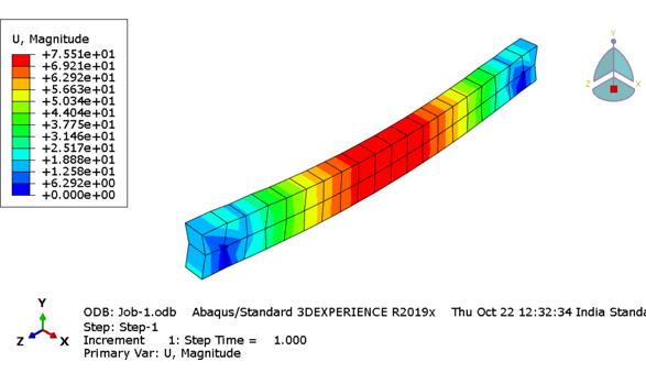
Reinforced Cement Concrete (RCC) Structure under Compression Load Conditions: ABAQUS/SIMULIA
Introduction The RCC structure displayed below is subjected to displacement under static conditions in ABAQUS GUI. The basic purpose of using RCC is to absorb…

How to model a structure undergoing global instability in Abaqus?
A nonlinear static problem can be unstable as a result of global buckling or material softening. If the load-displacement response of the model seems to…
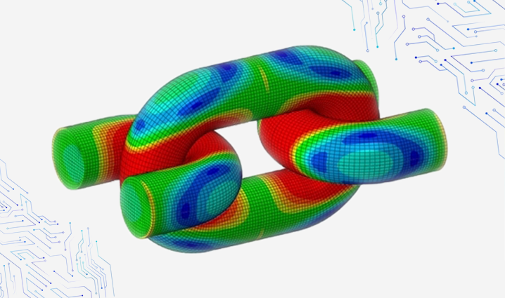
How to Enforce Contact Constraints using Augmented Lagrangian Method in Abaqus/Standard?
There are three methods of contact constraint enforcement that are available in Abaqus/Standard: The direct Lagrange multiplier method, The augmented Lagrangian method, and The penalty…

Evolution of Geospatial technology and emerging trends in the industry
A few years back, if you had to travel from point A to point B and had never been to that area, you had to…

