The Power of GIS for Homeland Security

Geospatial Information Systems (GIS) have become an indispensable tool in homeland security, providing agencies and organizations with the critical insights necessary for informed decision-making and rapid response. GIS technology enables the mapping, analysis, and visualization of spatial data, which is crucial for managing a wide range of security challenges—from disaster response to counterterrorism efforts. 

In this blog, we’ll explore how GIS plays a pivotal role in enhancing the effectiveness of homeland security operations, ensuring public safety, and responding to emergencies with greater precision and speed. 


GIS and Threat Detection

Homeland security often involves tracking and mitigating potential threats—whether from natural disasters, terrorism, or other emergencies. GIS serves as a powerful tool to support threat detection and prediction. By integrating real-time data from a variety of sources—such as surveillance cameras, sensor networks, and social media—GIS platforms enable analysts to monitor and assess potential threats quickly and effectively. 

For example, GIS can be used to monitor suspicious activities at key infrastructure sites or high-profile events. By mapping out areas of interest and overlaying them with real-time data, security personnel can pinpoint abnormal patterns or unusual concentrations of activity, allowing for early intervention before a threat escalates. 


Emergency Response and Disaster Management 

In emergency management, GIS provides a comprehensive approach to disaster preparedness, response, and recovery. Whether it’s a natural disaster like a hurricane or a man-made crisis such as a terrorist attack, GIS allows emergency responders to quickly assess the situation, plan evacuation routes, and coordinate resources effectively. 

For instance, during an evacuation, GIS can be used to identify the safest and fastest routes for civilians, taking into account factors such as road conditions, traffic patterns, and environmental hazards. By leveraging GIS, agencies can improve situational awareness, prioritize efforts, and ensure a more efficient response, ultimately saving lives.


Critical Infrastructure Protection 

Securing critical infrastructure, such as power plants, transportation networks, and communication systems, is a major focus of homeland security efforts. GIS plays an essential role in mapping and analyzing the vulnerabilities of these infrastructures, as well as in planning and coordinating their protection. 

With GIS, homeland security agencies can perform detailed risk assessments to identify areas that are most susceptible to threats, including natural disasters or terrorist attacks. By modeling various risk scenarios, agencies can better allocate resources, fortify key infrastructure, and develop effective protection strategies to reduce the impact of potential attacks.


Surveillance and Border Security

Maintaining border security is a complex challenge that demands the integration of multiple technologies and data sources. GIS enables law enforcement and border control agencies to analyze geospatial data from satellite imagery, drones, and ground sensors to monitor borders, identify illegal crossings, and track the movement of individuals or vehicles. 

In addition, GIS can be integrated with other security systems, such as facial recognition or vehicle license plate tracking, to provide a more comprehensive picture of activity along borders. By visualizing movement patterns in real-time, authorities can make quicker decisions, deploy resources to critical areas, and even predict potential breaches before they occur. 


Data Integration and Decision Support 

One of the most valuable features of GIS in homeland security is its ability to integrate data from a wide range of sources into a single platform. From social media feeds to satellite imagery, GIS helps create a unified view of a security situation. This is critical for decision-makers who rely on up-to-date, accurate data to manage complex security operations. 

GIS platforms like ArcGIS Pro allow users to combine disparate data layers—such as infrastructure maps, demographic data, and environmental conditions—into a cohesive, actionable map. This enhances decision support, as officials can visualize and analyze multiple factors simultaneously, making it easier to assess risks, allocate resources, and plan interventions. 


Training and Simulation 

Another key aspect of GIS in homeland security is its role in training and simulation. GIS-based simulation tools allow security agencies to create realistic training scenarios for their personnel. Whether it’s preparing for a terrorist attack, a cyber threat, or a natural disaster, GIS can simulate various emergency situations and help personnel practice their responses. 

For example, a simulated terrorist attack in a crowded urban area can be modeled with GIS, allowing responders to plan evacuation routes, coordinate resources, and assess the effectiveness of different strategies. These simulations provide invaluable practice and preparation for real-world events, improving response times and outcomes when disaster strikes. 


The Future of GIS in Homeland Security 

As technology continues to evolve, so too does the potential of GIS in homeland security. Advances in artificial intelligence (AI), machine learning, and big data analytics are opening up new possibilities for security applications. GIS platforms are becoming more sophisticated, capable of handling vast amounts of data from diverse sources and providing real-time insights to decision-makers. 

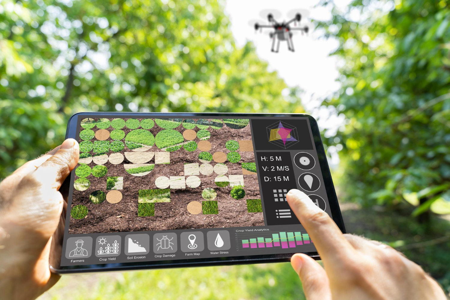
One of the most exciting developments is the integration of GIS with unmanned aerial systems (UAS) and drones. Drones equipped with high-resolution cameras and sensors can capture critical data in hard-to-reach areas, such as disaster zones or remote borders. This data can be fed into GIS systems for real-time analysis, offering a dynamic view of the situation on the ground. 

Geospatial technologies are transforming the landscape of homeland security, providing agencies with the tools they need to respond quickly and effectively to emerging threats. From enhancing situational awareness to improving response times, GIS is at the heart of modern security strategies. 

As GIS technology continues to evolve, its role in homeland security will only become more integral. Whether it’s through better threat detection, faster disaster response, or more effective infrastructure protection, GIS is helping to ensure a safer, more secure world for all. 

By leveraging the full potential of GIS, homeland security agencies can stay one step ahead, making smarter, data-driven decisions that protect people, infrastructure, and national security. 

Advanced Tyre Analysis with SIMULIA: Unveiling the Secrets of Performance and Durability

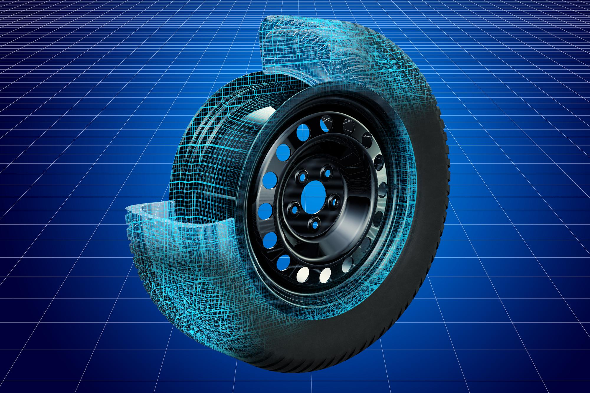
When it comes to automotive engineering, the tyre is one of the most critical components influencing vehicle performance, safety, and durability. Tyres are one of the most important components of the vehicle. The brakes stop the wheels, not your car! It’s actually your tyres that stop the car, through a contact patch no larger than an 8 ½ X 11 inches sheet of paper. Understanding tyre behavior under various conditions—whether on dry, wet, or rough terrains—requires advanced simulation and testing. This is where SIMULIA, Dassault Systèmes’ powerful suite of simulation tools, comes into play. SIMULIA’s capabilities offer automotive engineers the tools to perform detailed tyre analysis, enabling more efficient design, testing, and optimization processes. 


The Importance of Tyre Analysis in Automotive Design 

Tyres are the sole point of contact between a vehicle and the road. As such, their performance affects handling, comfort, fuel efficiency, braking efficiency, and even the overall safety of a vehicle. Tyres must strike a balance between traction, durability, and overall cost. Tyres must be designed to perform well under a variety of conditions, from extreme temperatures to varying road surfaces. However, designing such tyres through traditional physical testing methods can be time-consuming, costly, and potentially inefficient. 

SIMULIA addresses these challenges by offering powerful tools to simulate tyre behaviour across a wide range of real-world conditions. Through simulation, engineers can predict tyre performance early in the design cycle, reducing the need for expensive prototype testing and accelerating time-to-market. 

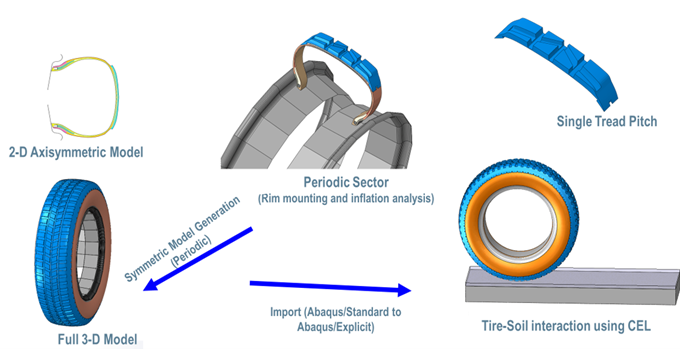
Fig.1: Integrated tyre workflow with one master model 


SIMULIA’s Role in Tyre Analysis 

SIMULIA provides comprehensive simulation solutions that enhance the design and testing of tyres. The platform integrates advanced finite element analysis (FEA), multi-body dynamics (MBD), and computational fluid dynamics (CFD) to give engineers an in-depth understanding of tyre performance. 

Here are some of the key aspects of tyre analysis that SIMULIA excels in: 

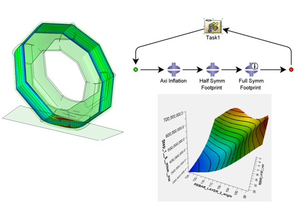
  • Tyre Performance Modelling: SIMULIA’s Abaqus and Isight tools allow for precise modelling of tyre materials and structures. Engineers can simulate how different materials (rubber compounds, reinforcements, etc.) behave under stress and deformation, which is essential for determining tyre longevity and performance. By simulating the tyre’s interaction with various road surfaces and temperatures, engineers can optimize tread patterns, sidewalls, and overall tyre construction. 

Fig.2: Tyre ply angle optimization 


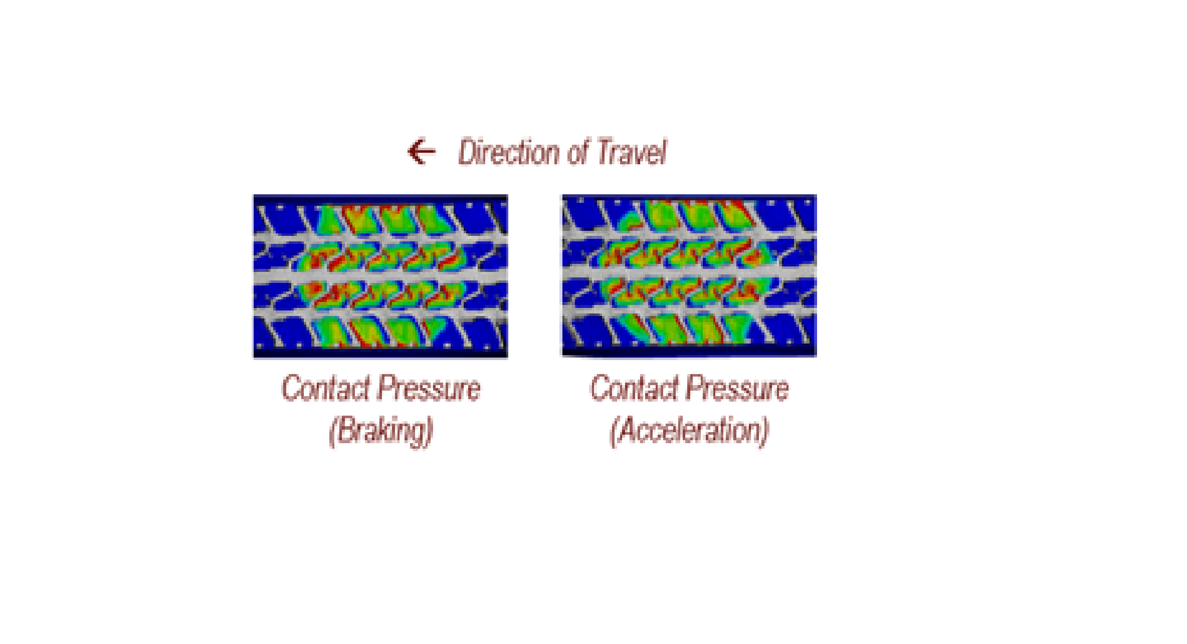
  • Stress and Strain Analysis: Tyres undergo significant stress during operation, from the forces generated by braking and acceleration to the impacts from road obstacles. SIMULIA’s Abaqus allows for the detailed simulation of tyre deformation under these forces. Engineers can visualize tyre strain patterns, identify areas of high stress, and optimize designs to enhance durability, comfort, and performance. 

Fig.3: Contact pressure pattern 


  • Rolling Resistance and Fuel Efficiency: Rolling resistance is a critical factor in vehicle fuel efficiency. SIMULIA enables the analysis of rolling resistance through tyre-road interaction models, allowing designers to minimize energy losses while maximizing performance. By understanding the effects of tyre tread design and rubber compounds on rolling resistance, automotive manufacturers can produce tyres that contribute to better fuel economy and lower emissions. 


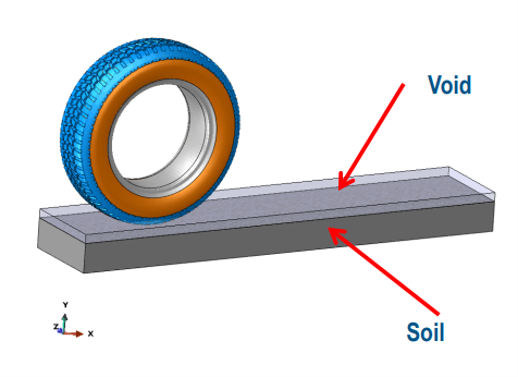
  • Tyre-Road Interaction: The interaction between a tyre and the road surface is complex. SIMULIA’s capabilities help engineers simulate how tyres interact with different surfaces—whether dry, wet, icy, or gravel. These simulations take into account parameters like friction, contact pressure, and deformation, helping to predict tyre behavior under various driving conditions. This ensures that tyres provide the necessary grip and stability, improving safety and handling. 

Fig.4: Tyre-Soil interaction 


  • Wear and Durability Analysis: The durability of a tyre is influenced by various factors, including its design, material properties, and driving conditions. Using SIMULIA’s fatigue and wear simulation tools, engineers can predict tyre lifespan, identify potential failure points, and optimize tyre design to maximize durability. This can lead to improved tyre longevity and reduced maintenance costs for consumers.


  • Noise and Vibration Analysis: Tyres generate noise and vibrations, which can negatively affect the ride comfort of a vehicle. SIMULIA’s simulation tools help engineers analyze and mitigate these effects. By optimizing tyre design, including tread patterns and material choices, engineers can reduce road noise and vibrations, enhancing the overall driving experience. 


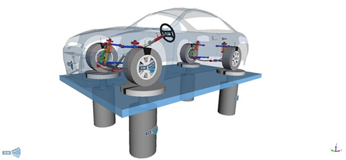
  • Multi-Body Dynamics (MBD) Simulations: Tyres play a critical role in vehicle dynamics, influencing handling, stability, and safety. SIMULIA’s Simpack and Abaqus tools offer multi-body dynamics simulations that model the entyre vehicle system. Engineers can simulate how the tyre interacts with the suspension system, steering, and braking systems to optimize vehicle handling and performance. These simulations can account for tyre deformation, camber, and contact patches, ensuring the vehicle’s stability and safety under various driving conditions. 

Fig.5: Hydropulse Test using SIMPACK


Benefits of Using SIMULIA for Tyre Analysis 

The integration of SIMULIA’s advanced simulation tools provides several key benefits for tyre design and testing: 

  • Cost Reduction: By simulating tyre behaviour early in the design process, engineers can reduce the need for expensive physical prototypes and testing. This leads to significant cost savings in the development cycle. 
  • Faster Time-to-Market: With detailed tyre simulations, manufacturers can accelerate the design process and shorten the time needed for testing, resulting in faster product launches. 
  • Improved Tyre Performance: Advanced simulations allow for the optimization of tyre materials, tread patterns, and structures, ensuring better performance in terms of handling, safety, fuel efficiency, and durability. 
  • Enhanced Safety: By accurately simulating tyre-road interactions and stress conditions, manufacturers can create safer tyres that perform reliably under various real-world conditions, ultimately improving vehicle safety for consumers. 
  • Sustainability: With the ability to optimize rolling resistance and material usage, SIMULIA helps manufacturers produce more fuel-efficient tyres that reduce environmental impact. 

Conclusion 

SIMULIA’s suite of simulation tools revolutionizes tyre analysis by offering automotive engineers the ability to simulate tyre behavior under a vast range of real-world conditions. By leveraging these tools, manufacturers can design more efficient, durable, and high-performance tyres, ultimately improving vehicle safety, comfort, and sustainability. The powerful capabilities of SIMULIA not only help reduce development costs and time-to-market but also enable the creation of tyres that meet the ever-growing demands of the automotive industry and consumers. 

Additive Manufacturing for Medical Device Manufacturing

In the rapidly evolving landscape of additive manufacturing (AM), commonly known as 3D printing, this technology has emerged as a transformative force, revolutionizing various industries. Healthcare stands at the forefront of this revolution, leveraging the advanced capabilities of AM to enhance patient care and improve medical outcomes. This cutting-edge technology is revolutionizing the way medical devices are designed, manufactured, and utilized, offering unprecedented possibilities for personalized implants and surgical tools, complex geometries, and rapid prototyping. Let’s delve into the significant impact of additive manufacturing on medical devices and the benefits of using AM in medical field applications.  


What is Medical Additive Manufacturing 

Medical additive manufacturing (AM) is the process of creating medical devices and structures using computer-aided design (CAD) and advanced 3D printing techniques. A digital model is sent to a 3D printer, which constructs the object by building up layers of material. Depending on the desired properties of the final object, the printer can use a variety of materials such as polymers and metals. 

Medical AM offers several advantages over traditional manufacturing methods, including the ability to create complex geometries, reduce patient wait times, and enhance surgical accuracy. This technology enables the precise fabrication of patient-specific prosthetics, orthopedic implants, leading to improved patient outcomes and shorter surgery times. By constructing objects layer by layer, additive manufacturing provides unparalleled design flexibility and rapid prototyping, making it an invaluable tool in advancing medical treatments and innovations. 


Personalized Medical Devices 

One of the most profound advantages of additive manufacturing in the medical field is its ability to produce patient-specific devices. Traditional manufacturing methods often rely on standardized sizes and shapes, which may not perfectly fit every patient. However, with AM, medical professionals can create custom implants, prosthetics, and orthotics tailored to an individual’s unique anatomy. This personalized approach enhances the comfort, functionality, and overall outcomes for patients. 

For instance, in orthopedic surgery, customized implants designed using 3D printing technology can significantly reduce the risk of complications and improve the integration with the patient’s bone structure. Similarly, in dentistry, 3D-printed crowns, bridges, and dentures offer a perfect fit, ensuring better oral health and aesthetics. 


Complex Geometries and Innovative Designs 

Additive manufacturing allows for the creation of intricate and complex geometries that are often impossible or extremely challenging to achieve with conventional manufacturing techniques. This capability opens new avenues for innovative medical device designs that enhance functionality and performance. 

For Example, Cranial implants created using 3D printing represent a significant advancement in medical technology, offering customized and precise solutions for patients with skull defects or injuries. This innovative approach allows for the production of patient-specific implants that perfectly match the unique contours of an individual’s cranial anatomy, ensuring better integration and improved outcomes. By utilizing biocompatible materials and advanced imaging techniques, 3D-printed cranial implants not only enhance the aesthetic and functional aspects of reconstruction but also reduce surgery time and associated risks, paving the way for more effective and personalized medical treatments. 


Rapid Prototyping and Accelerated Development 

The iterative nature of additive manufacturing significantly accelerates the development process of medical devices. Rapid prototyping allows designers and engineers to quickly produce and test multiple iterations of a device, making necessary adjustments in real time. This agility reduces the time and cost associated with bringing new medical devices to market. 

During the COVID-19 pandemic, the agility of 3D printing enabled the rapid production of essential medical supplies, such as ventilator components, face shields, and nasal swabs. This swift response highlighted the critical role of additive manufacturing in addressing urgent healthcare needs, demonstrating its potential to adapt quickly to unexpected challenges and provide vital support in times of crisis. 


Cost-Effective and Sustainable Solutions 

Additive manufacturing offers cost-effective solutions by minimizing material waste and reducing the need for extensive tooling and molds. This efficiency translates to lower production costs, making advanced medical devices more accessible and affordable. Additionally, the ability to produce devices on-demand reduces inventory costs and the need for large storage spaces. 

 Furthermore, the sustainability of additive manufacturing cannot be overlooked. The technology’s precision reduces material waste, and the use of biocompatible and biodegradable materials aligns with the growing emphasis on environmentally friendly practices in healthcare. 


Conclusion 

Additive manufacturing is undeniably reshaping the landscape of medical device printing, offering unprecedented opportunities for personalized, innovative, and cost-effective solutions. As this technology continues to advance, it holds the potential to revolutionize healthcare by improving patient outcomes, accelerating device development, and fostering sustainable practices. Embracing the possibilities of additive manufacturing, the medical industry stands at the forefront of a new era in healthcare innovation. 

GIS in Retail

In the dynamic retail landscape, precise data analysis and strategic planning are paramount. Geographic Information Systems (GIS) have become indispensable tools, empowering retailers to make informed decisions, optimize operations, and maintain a competitive advantage. 

By harnessing the insights gleaned from location data, retailers can conquer new markets, optimize store footprints, streamline logistics, and gain a significant competitive edge. From identifying prime real estate for new stores to understanding customer behavior patterns, GIS empowers data-driven decision-making at every level of the retail operation. 


New Territory Expansion 

Expanding into new territories is a critical growth strategy for many retailers. GIS technology facilitates this process by providing detailed spatial analysis and demographic data. Retailers can identify potential markets by examining population density, income levels, consumer behavior patterns, and existing retail footprints. This enables businesses to strategically target areas with the highest growth potential, reducing the risks associated with expansion and ensuring a higher return on investment. 


Optimal Store Location 

Choosing the right location for a new store can significantly impact its success. GIS technology allows retailers to analyze various factors such as foot traffic, proximity to competitors, accessibility, and local demographics. By visualizing these elements on a map, retailers can identify prime locations that maximize visibility and attract the target customer base. This data-driven approach helps in making informed decisions that lead to profitable and sustainable store placements. 


Supply Chain and Logistics Planning 

Efficient supply chain and logistics planning are crucial for maintaining a competitive edge in retail. GIS technology enables retailers to optimize their supply chain networks by analyzing transportation routes, warehouse locations, and delivery zones. By visualizing the entire supply chain on a map, retailers can identify bottlenecks, reduce transportation costs, and improve delivery times. This ensures that products are always available on the shelves, enhancing customer satisfaction and loyalty. 


Market Research and Competitor Analysis

Staying ahead of the competition requires a deep understanding of the market landscape. GIS technology aids in conducting comprehensive market research by aggregating data on consumer preferences, spending patterns, and market trends. Retailers can also perform competitor analysis by mapping the locations of rival stores and analyzing their market share. This information allows businesses to identify opportunities for differentiation, develop targeted marketing strategies, and gain a competitive advantage. 


Conclusion

Incorporating GIS technology into retail operations offers numerous benefits, from strategic territory expansion and optimal store placement to efficient supply chain management and insightful market research. By harnessing the power of GIS, retailers can make data-driven decisions that drive growth, improve operational efficiency, and enhance customer satisfaction. As the retail industry continues to evolve, embracing GIS technology will be key to staying competitive and achieving long-term success. GIS-based tools help in drawing insights from demographic data, which reveals the relationship between location and people. 

Extended Simulation of Wind Turbines Using ABAQUS

Wind turbines are pivotal in the global transition towards renewable energy systems. Accurate simulation of wind turbines using advanced finite element analysis (FEA) tools like ABAQUS enables engineers to design more efficient, reliable, and durable systems. In this blog, we will delve into the process of simulating wind turbines using ABAQUS, focusing on structural, aerodynamic, and fatigue analyses. 


Key Components of Wind Turbine Simulation 
  • Blade Analysis: Wind turbine blades endure complex loads, including aerodynamic forces, gravitational effects, and centrifugal forces. ABAQUS’ advanced material modeling capabilities are ideal for analyzing composite blades. 
  • Tower Structure: The tower must withstand wind loads and dynamic effects from the rotor. Structural stability under cyclic loads is crucial. 
  • Rotor-Nacelle Assembly: This component converts wind energy into mechanical energy. Simulation focuses on the interaction between rotating parts and the structural housing. 
  • Foundation: The foundation supports the entire structure, transferring loads to the ground. Soil-structure interaction plays a key role in ensuring stability. 

Extended Steps for Wind Turbine Simulation
  • Geometry Creation:
    • Create the geometry of the wind turbine using CAD software or directly in ABAQUS/CAE. This includes the blade, tower, rotor, nacelle, and foundation. 
    • The geometry should represent real-world conditions, incorporating precise measurements and aerodynamic designs.
  • Material Properties:
    • Assign material properties for each component. For example: 
    • Blades: Composite materials (e.g., carbon fiber reinforced polymers). 
    • Tower: Steel or other high-strength alloys. 
    • Foundation: Concrete or reinforced concrete
  • Meshing:
    • Generate a fine mesh for accurate results, particularly for critical regions like blade edges and tower connections. 
    • Use hexahedral elements for simpler shapes and tetrahedral elements for complex geometries. 
    • Perform mesh convergence studies to ensure solution accuracy.
  • Boundary Conditions:
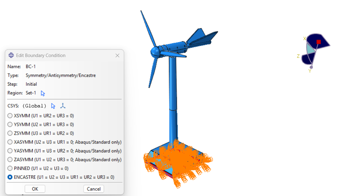
    • Fix the base of the tower to represent its connection to the foundation. 
    • Apply wind loads along the length of the blades and lateral forces on the tower. 
    • Include gravity and centrifugal forces for realistic loading conditions. 
  • Load Cases:
    • Static Loads: Simulate constant wind conditions for structural stability analysis. 
    • Dynamic Loads: Use time-varying wind loads for transient and fatigue analysis. 
    • Extreme Events: Model conditions such as gusts or shutdown scenarios. 
  • Analysis Setup:
    • Use the Static General step for structural integrity checks under steady loads. 
    • For time-dependent studies, employ the Explicit Dynamics or Implicit Dynamics solver. 
    • Include non-linear effects such as large deformations and material plasticity for blades and tower sections. 
  • Post-Processing:
    • Use ABAQUS/CAE’s visualization module to evaluate stress distribution, deformation, and vibration modes. 
    • Identify critical regions for design improvement, such as areas with high stress concentrations. 

Case Study: Blade Deformation 

Objective: 

To evaluate the deformation of a wind turbine blade under cyclic aerodynamic loads. 

Steps: 

  • Modeling: The blade was modeled with composite layups to represent real-world manufacturing processes. 
  • Loading: A cyclic wind load was applied over 1,000 load cycles.

Results: 

  • Stress concentrations were observed at the root of the blade. 
  • The fatigue analysis highlighted a potential failure region, prompting geometry and material modifications. 


INP File for Blade Analysis 

Below is an example of a basic INP file setup for wind turbine blade analysis: 


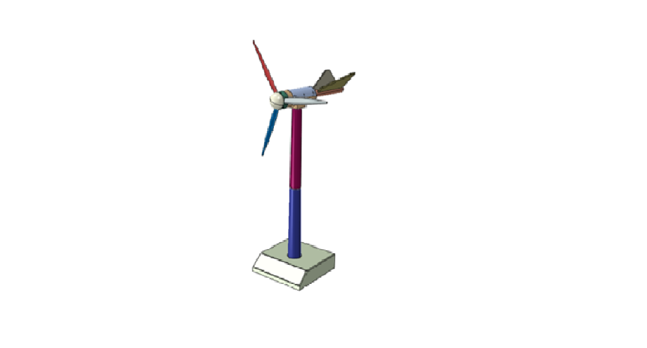
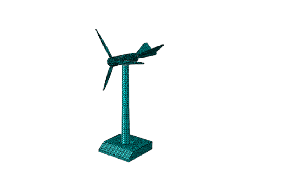
CAD, Meshed, and Result Images 

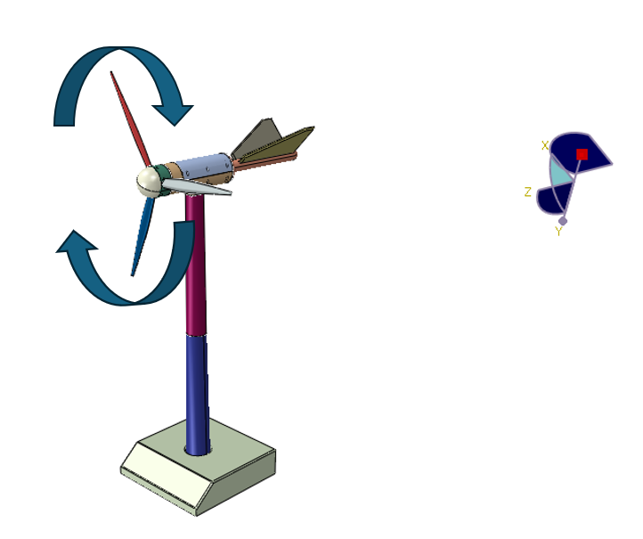
  • CAD Model of the Wind Turbine: 


  • Meshed Model: 


Conclusion 

Simulating wind turbines in ABAQUS enables engineers to refine designs for efficiency and reliability. With detailed CAD models, accurate meshing, and comprehensive analysis, engineers can optimize turbine performance and reduce failure risks. Leveraging tools like ABAQUS for wind turbine simulation is a step towards achieving a sustainable energy future.

Leveraging GIS in Forestry: Revolutionizing Forest Management

According to the India State of Forest Report (ISFR) 2021, released by the Ministry of Environment, Forests, and Climate Change, India’s total forest area constitutes 21.71% of the country’s geographical area, while the tree cover is estimated to be 2.91%. Consequently, the combined coverage of forests and trees accounts for 24.62% of the nation’s geographical area. Geographic Information Systems (GIS) have emerged as a cornerstone for effective forest management and conservation. By integrating diverse datasets and offering sophisticated spatial analysis tools, GIS empowers foresters, ecologists, and conservationists to make data-driven decisions, optimize resource allocation, and effectively address pressing environmental concerns. 


Mapping Forest Resources

GIS plays a crucial role in generating comprehensive maps that provide detailed insights into forest composition, structure, and ecological health. High-resolution satellite imagery and aerial surveys are integrated within GIS platforms to produce accurate and up-to-date forest maps. These maps enable forest managers to effectively monitor changes in forest cover over time, such as deforestation, forest degradation, and the impacts of natural disturbances like wildfires and storms.


Forest Planning and Management

Regular updates and revisions are essential to sustain forest preservation efforts and enhance green cover. The forest department leverages GIS and remote sensing technologies to improve its capabilities by providing critical input data such as forest density, forest type, and land resources. Additionally, GIS enables the inclusion of maps detailing road networks, settlements, and water bodies, facilitating the design of efficient management strategies. 


Wildfire Risk Assessment and Management

Wildfires pose a substantial threat to forest ecosystems worldwide. GIS serves as an invaluable tool for effective wildfire management by providing real-time data on fire behavior, prevailing weather conditions, and fuel availability. This critical information supports accurate predictions of fire spread, facilitates the planning and execution of fire suppression activities, and enables the strategic design of firebreaks. Furthermore, post-fire analysis conducted within a GIS environment assists in assessing the extent of damage and developing comprehensive restoration plans. 


 Forest Management

GIS and Remote Sensing technologies are essential for effective forest monitoring, allowing for the creation of detailed, digital maps of forests with irregular boundaries. Periodic updates provide accurate insights into forest changes, supporting the development of sustainable management strategies and disaster mitigation plans. Advanced satellite and drone imagery, along with techniques like False Colour Composite (FCC) and True Colour Composite (TCC), enable precise monitoring of forest coverage, with FCC enhancing features not visible to the human eye, aiding in the detection of forest cover changes. 


Habitat Mapping and Biodiversity Conservation

Forests serve as vital habitats for a diverse array of flora and fauna. GIS plays a pivotal role in habitat mapping and biodiversity conservation by enabling the identification of critical habitats and biodiversity hotspots. Through spatial analysis, GIS facilitates the assessment of habitat fragmentation, connectivity, and the impact of human activities on wildlife populations. This valuable information empowers conservationists to effectively design and implement protected areas, establish wildlife corridors, and develop comprehensive management plans that safeguard biodiversity. 


Conclusion

The integration of GIS in forestry has transformed the way forests are managed and conserved. From mapping and monitoring, planning to disaster management, GIS provides the tools and insights necessary for sustainable forest management. As technology continues to advance, the role of GIS in forestry will only become more critical, helping us protect and preserve our valuable forest ecosystems for future generations. 

By leveraging the power of GIS, we can ensure that our forests remain healthy, resilient, and productive, supporting biodiversity and providing essential ecosystem services. 

Subscribe to our newsletter

Get all the latest information on Events, Sales and Offers.