Advanced terrain and 3D content creation environment empowers defence organizations to create high-fidelity, geo-specific environments for mission planning, training, and operational analysis. Tools like Terra Vista and Aechelon’s Geo-Specific Databases generate detailed terrain models, while VR-TheWorld streamline terrain data and features. DI-Guy enhances realism by integrating human characters into simulations, and Creator, PixelBlender, Digibati, and AG 3D Tools refine textures, lighting, and object details. These solutions provide military forces with highly immersive, data-driven environments to prepare for real-world scenarios, improving decision-making, situational awareness, and overall mission effectiveness.
Benefits

High-Fidelity, Real-World Environments
Tools like MAK VR-TheWorld and Aechelon Geo-Specific Databases create accurate, geo-specific terrains, enhancing mission planning and situational awareness.

Enhanced Realism in Training
DI-Guy and PixelBlender bring lifelike human characters and realistic visuals, improving engagement and effectiveness in defence simulations.

Efficient 3D Content Development
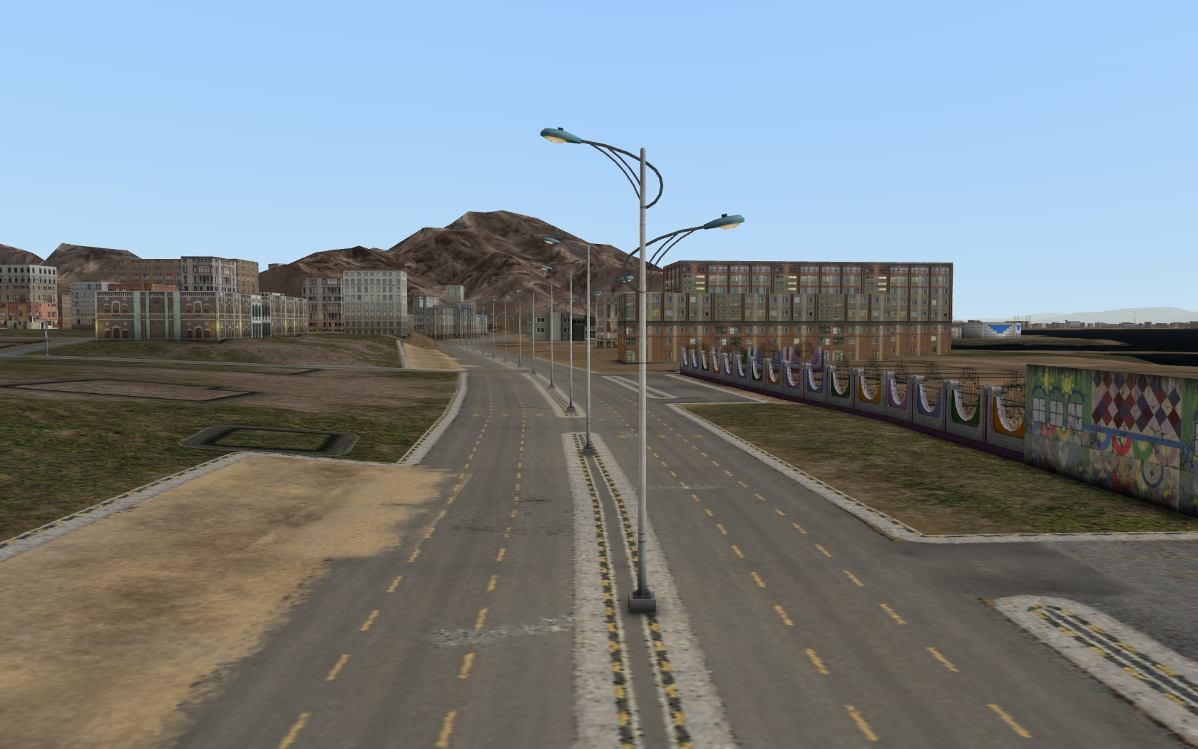
Terra Vista, Data Portfolio, and Digibati streamline the creation of detailed military assets, reducing development time and effort.

Better Decision-Making and Strategy Planning
Immersive simulations using AG 3D Tools and Creator allow defence forces to visualize complex scenarios, improving tactical readiness and operational efficiency.
What We Offer?
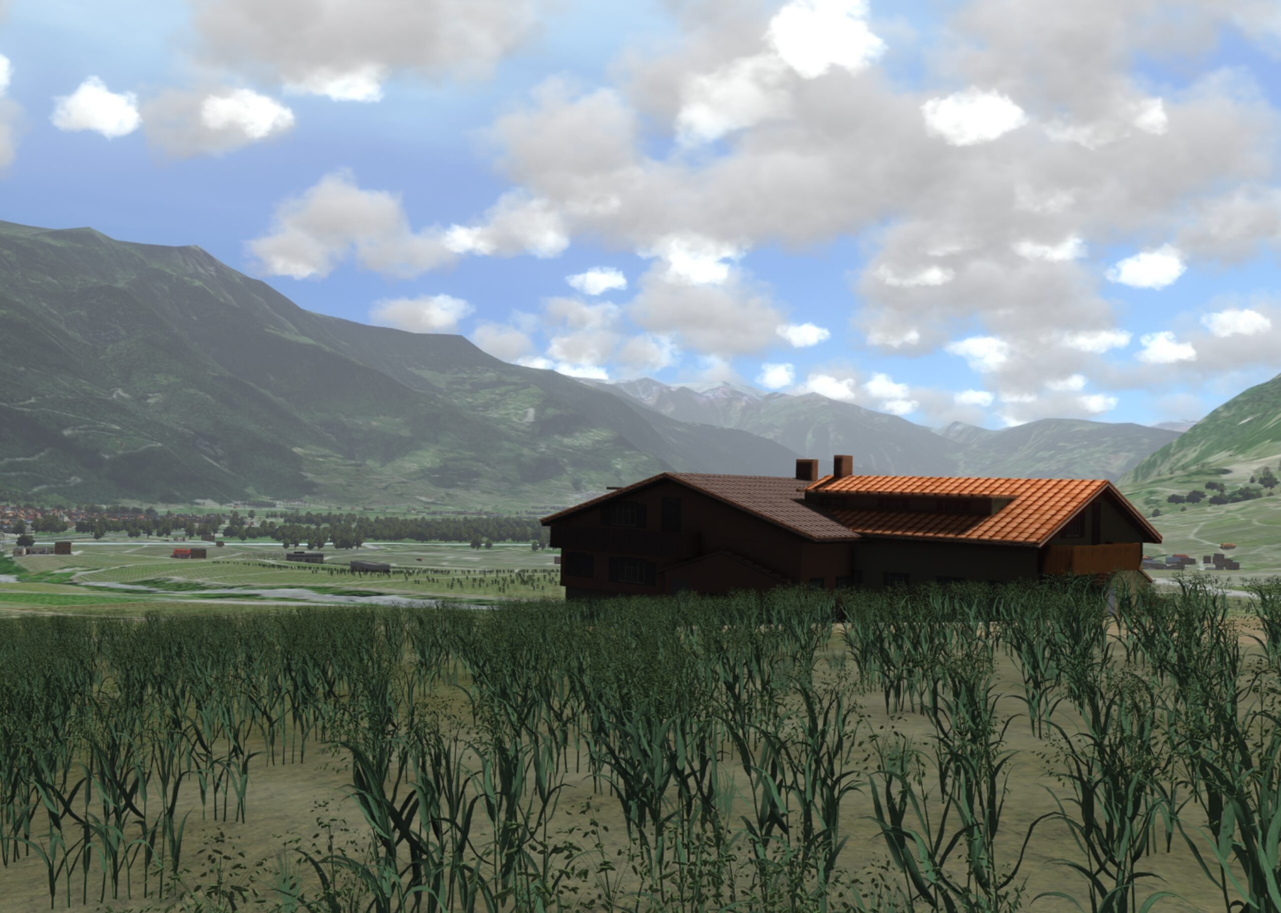
VR-TheWorld stores and streams the terrain data used to build MAK ONE Synthetic Environments. Elevation, imagery, and features including roads, buildings, and trees can be streamed to multiple applications simultaneously.
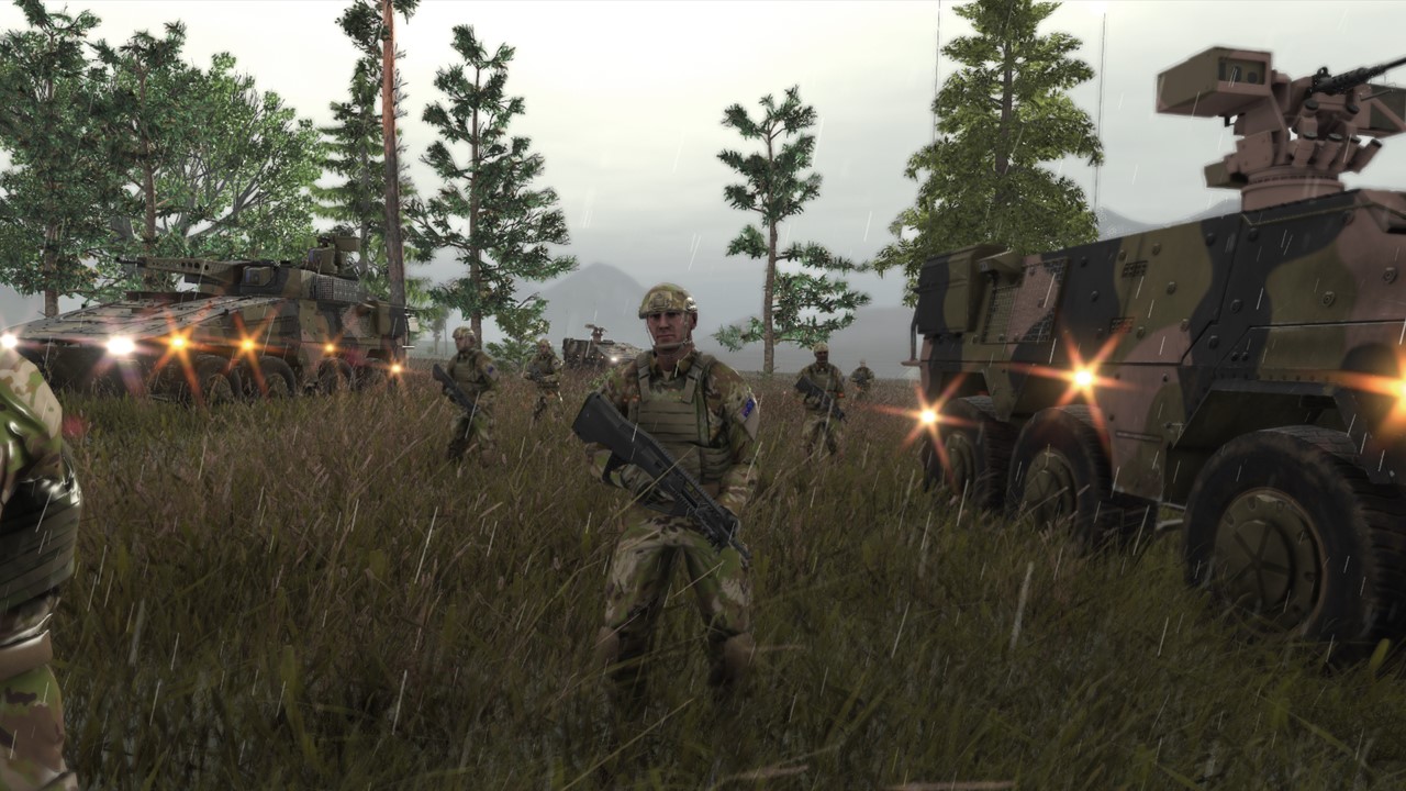
DI-Guy provides high-fidelity human characters that move realistically, respond to simple high-level commands, and travel throughout the environment as directed by the hosting visual application.
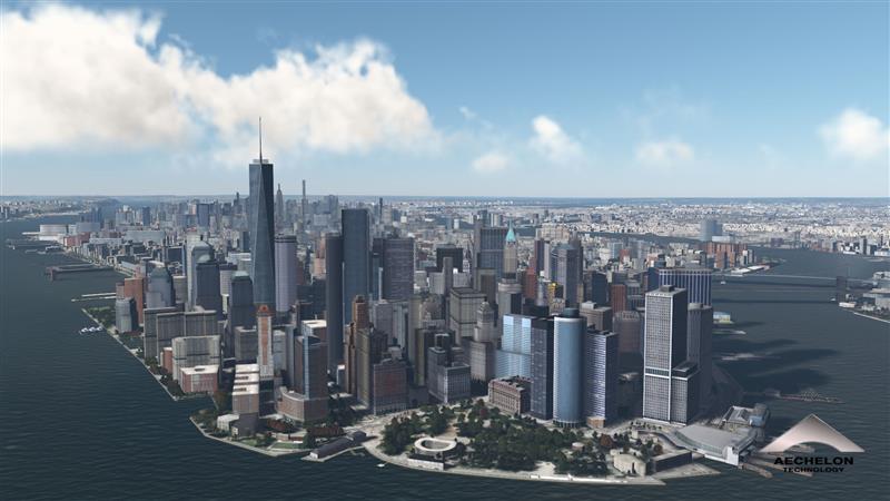
Geo-specific 3D worldwide databases provide ultra-realistic, highly detailed depictions of real-world global environments which are used to enhance mixed reality and flight simulation. End users employ geo-specific databases to conduct realistic mission rehearsal across multi-spectral real-world environments, drone-fed visualization for critical situational awareness during virtual ISR exercises, and even AI and ML model training.
Terra Vista is a leading-edge tool for creating high-fidelity, real-time 3D terrain databases tailored for simulation and visualization applications. Designed to meet the complex demands of industries such as defence, aviation, and geospatial analysis, Terra Vista transforms raw geospatial data into detailed, interactive environments.

Creator is a powerful 3D modeling software designed for real-time simulations, offering advanced tools to build, edit, and optimize models. Creator supports a wide range of import and export formats, ensuring interoperability across 3D modeling platforms.
PixelBender is used to harmonize heterogeneous geo-referenced imagery into homogeneous, seamless mosaics. It quickly processes large datasets, adjust tile size and resolutions with ease. It integrates data from different formats and quality levels into a consistent visually coherent output.
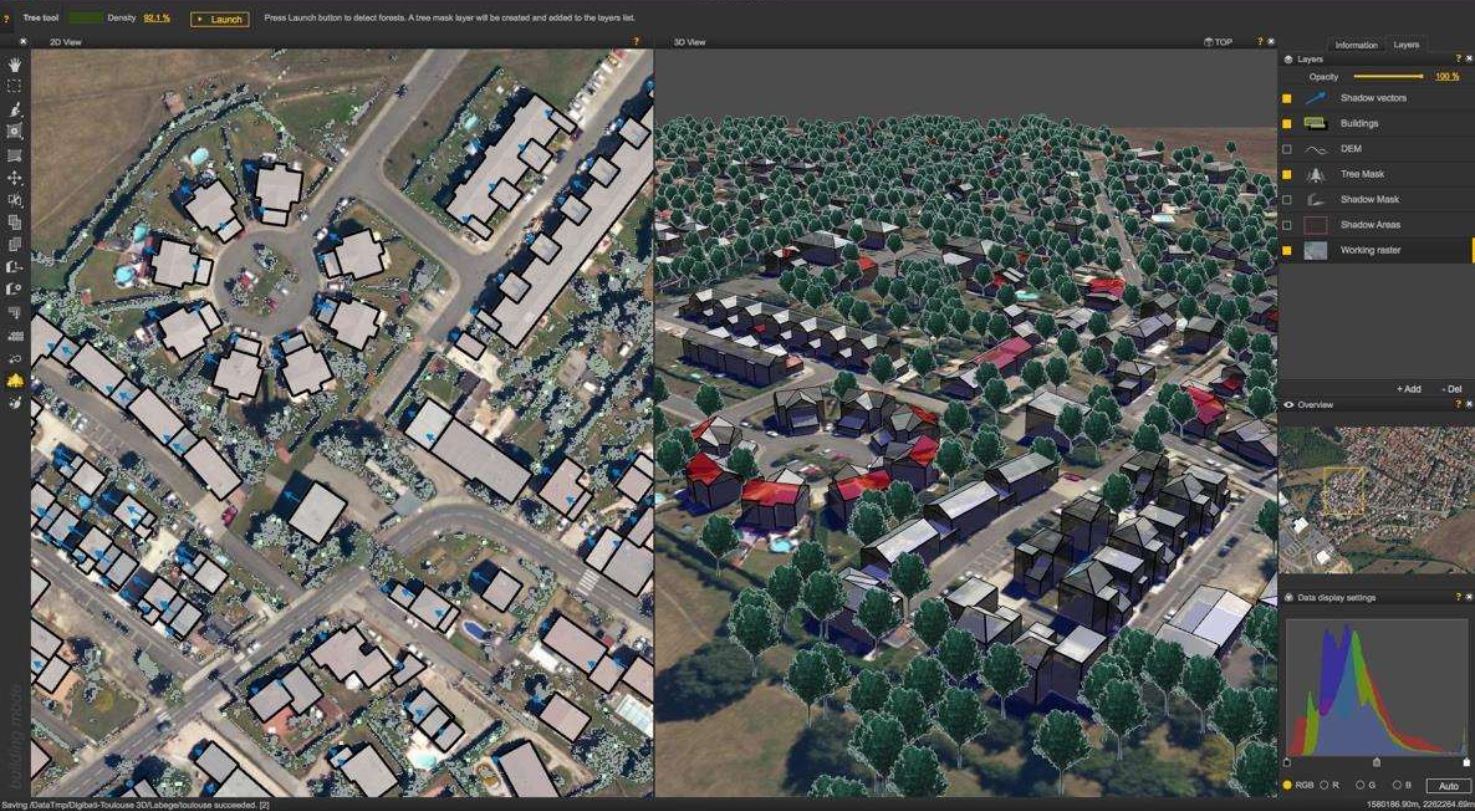
Digibati is a 3D data extraction tool from a satellite imagery. It can transform monoscopic images into detailed 3D models of buildings and trees. It is intuitive, customizable, and efficient production workflow.
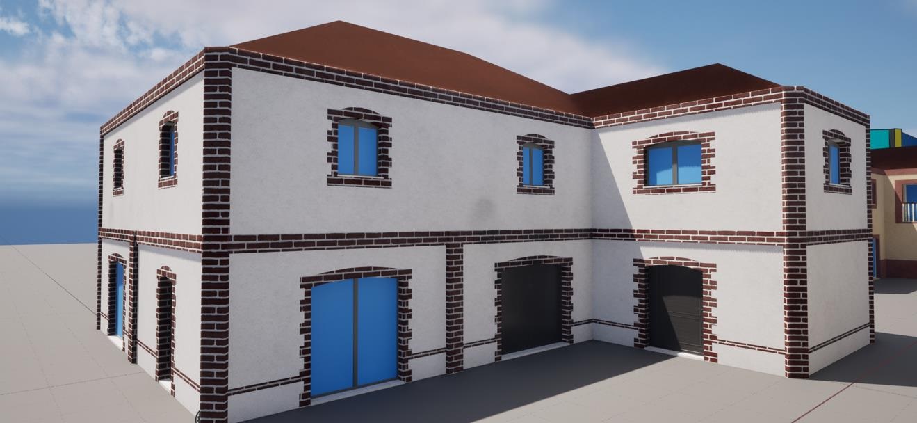
AG 3D Tools help in creating realistic models to fit simulation needs. The AG 3D tool assists in generating 3D models along linear paths, including bridges, road and railway networks, power lines – with pylons, cables, and hooks—as well as buildings.
Create Physical World within Synthetic Environments
Create realistic physical worlds within synthetic environments, enhancing visual simulations with high fidelity and precision.