Discover the resources across diverse industries including eBooks, brochures, flyers, and webcasts. Access valuable insights, detailed product information, and expert-led sessions to explore solutions in PLM, 3D printing, geospatial intelligence, engineering simulation, EDA, optical solutions and more. Empower your business with knowledge and tools for success.
Our Resources Library
Find everything that you need on our solutions
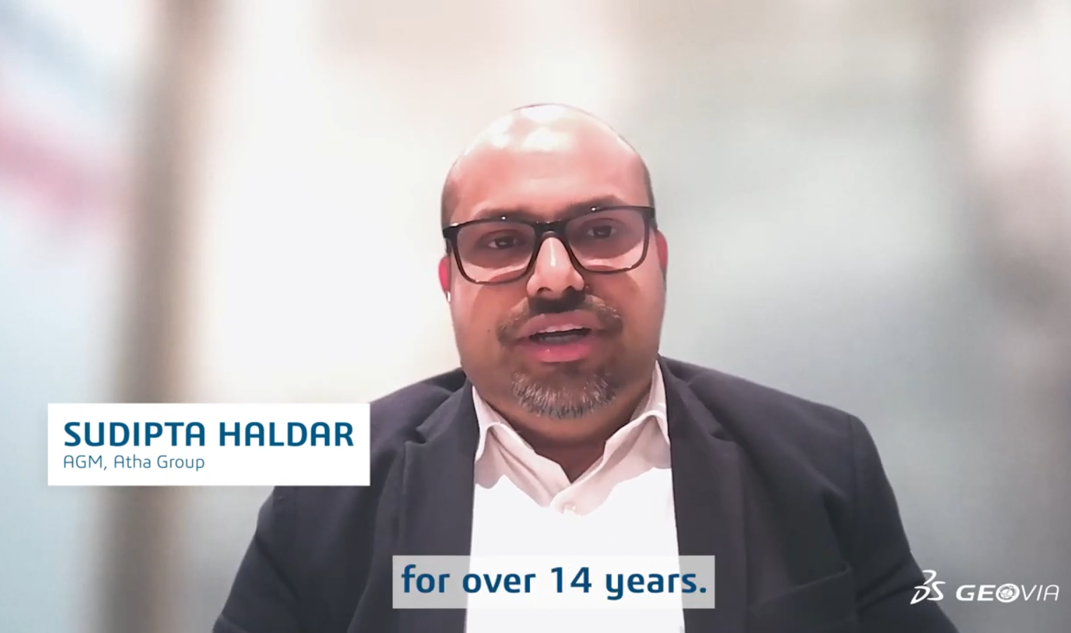
Atha Group Transforms Mine Planning with GEOVIA
Sudipta Haldar, a seasoned mining professional highlights the transformative impact of GEOVIA solutions—particularly Surpac on mining operations. Watch the video to see how GEOVIA is…
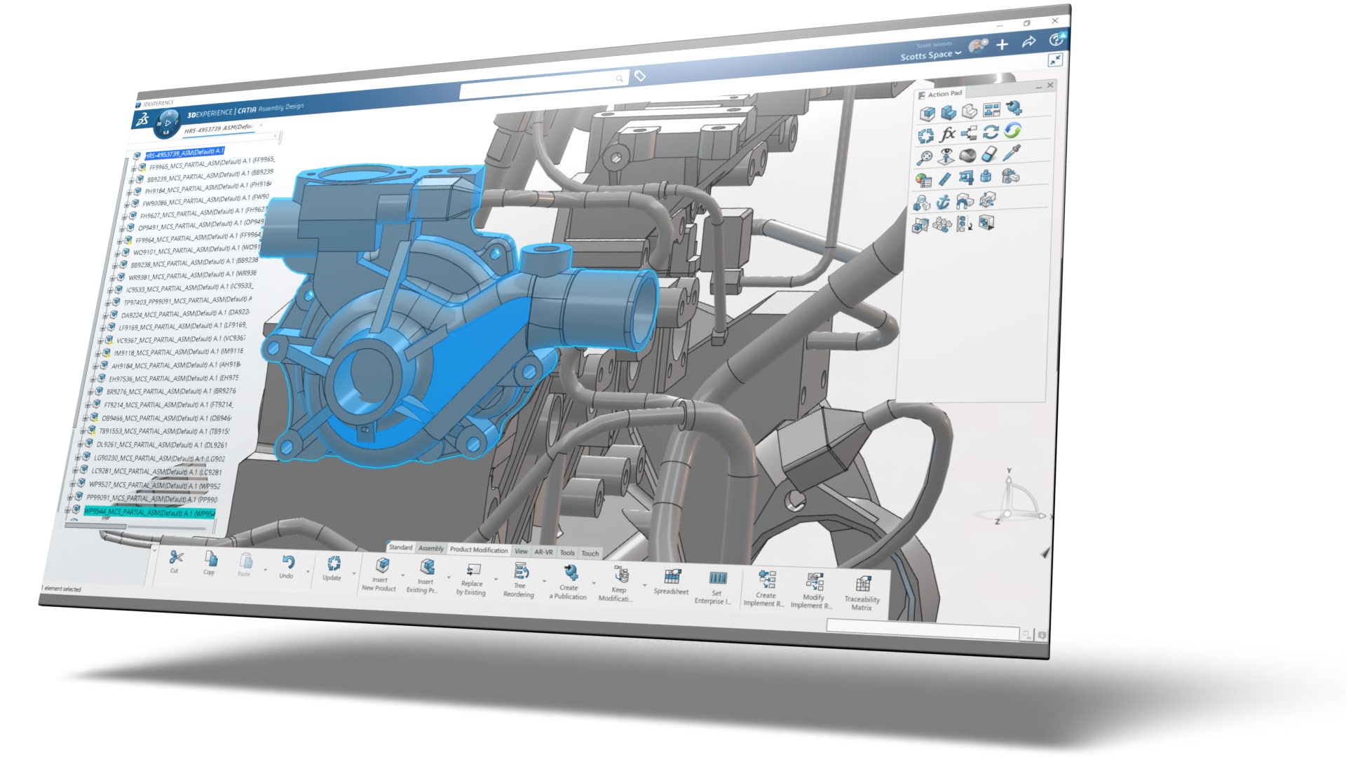
Managing CAD and CAE – Streamlined Design and Simulation Environments
Computer-Aided Design (CAD) and Computer-Aided Engineering (CAE) applications are critical to industries such as automotive, aerospace and manufacturing in general

What’s New in CODE V Version 2025.03
The CODE V 2025.03 release offers improvements that make it simple to model multiple operational environments. Enhancements to Multi-Environment Coupling allow you to optimise athermalized…
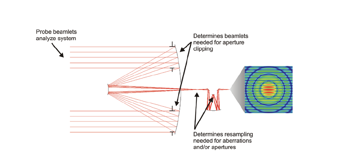
CODE V Beam Synthesis Propagation
The CODE V Beam Synthesis Propagation (BSP) feature sets an industry standard for accuracy, efficiency, and ease of use. BSP’s beamlet-based wave propagation algorithm includes…
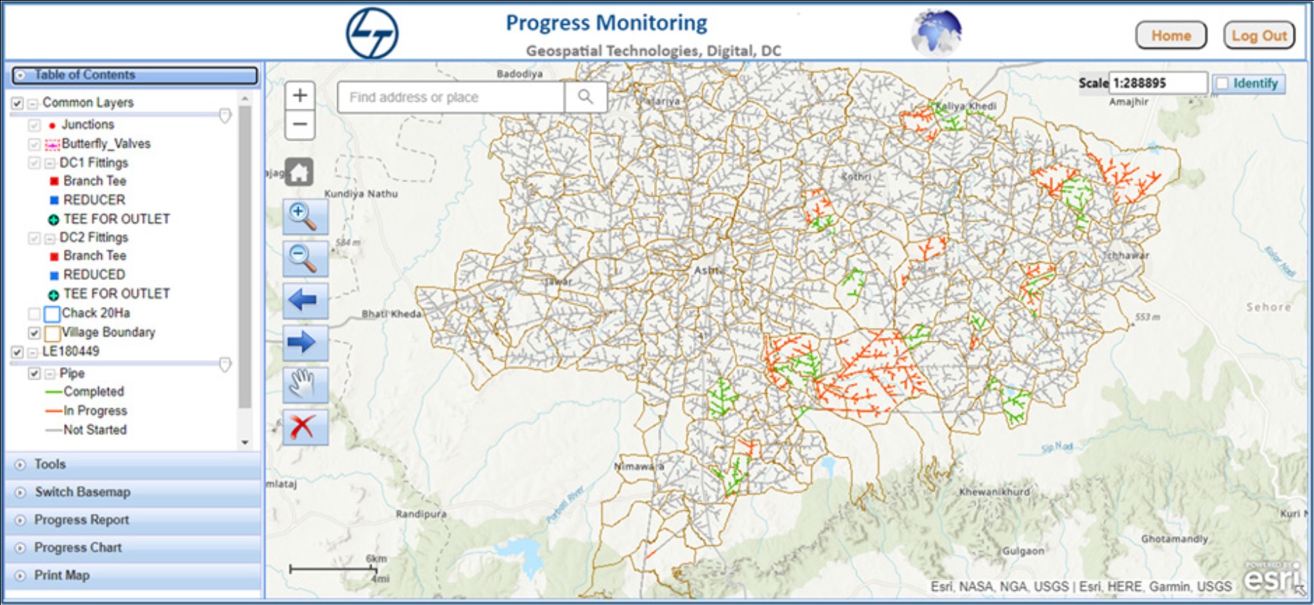
L&T Achieves Excellence in Irrigation Infrastructure Construction with ArcGIS
L&T secured orders from the Government of Madhya Pradesh Micro Lift Irrigation Schemes. The intent of the project is to provide water for micro irrigation…
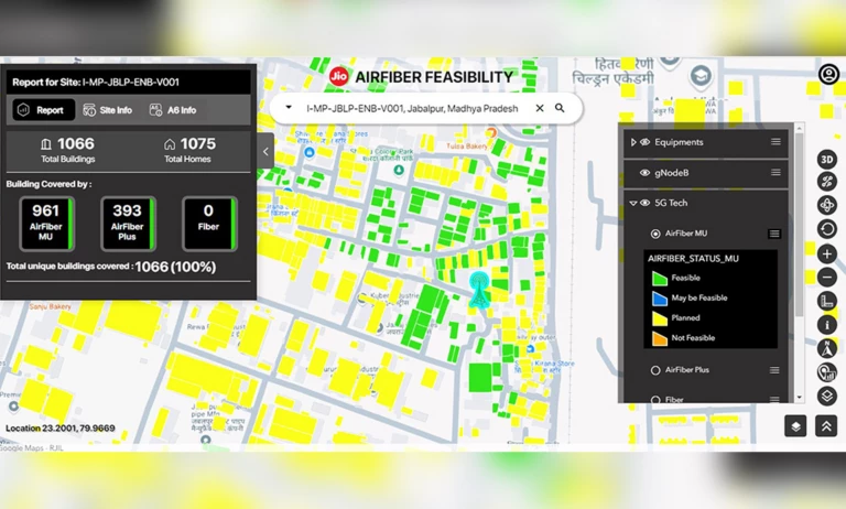
Jio Achieves Excellence in AirFiber Deployment across India with ArcGIS
As India raced into the digital future, Jio introduced a groundbreaking service: Jio AirFiber. Designed to deliver gigabit-speed broadband over the air using 5G and…

Optimizing Asset Inspection & Maintenance using GIS
Using GIS, utility service providers can track projects, document inspections, and streamline maintenance processes, leading to higher operational efficiency across the board.

Enabling Thrissur Municipal Corporation for Water Efficiency with ArcGIS
Thrissur Municipal Corporation’s Water Efficient Thrissur (WET) is an integration solution of GIS technology with Internet of Things (IoT) to optimize the water utility management…
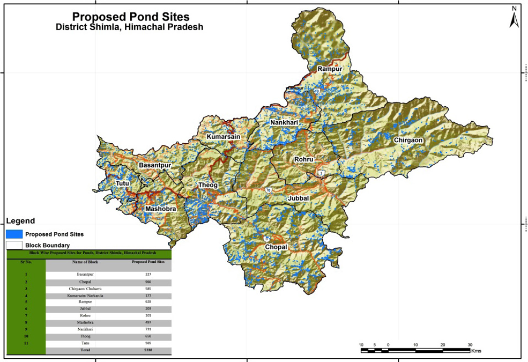
ArcGIS Facilitates Effective Governance in Himachal Pradesh
Aryabhatta Geo-informatics and Space Application Centre (AGiSAC) works to identify decision-making applications with the help of user departments and provides tailor-made GIS solutions for better…
Check Out Interesting Customer References
Across diverse industries and encompassing various solutions, discover the customer references in EDST Annual Calendars