Other trends

Infrastructure Protection and Critical Event Management
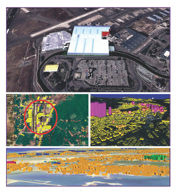
In Infrastructure Protection and Critical Event Management within Homeland Security, the primary goal is to safeguard vital infrastructure, such as transportation systems, energy grids, and communication networks, while effectively managing and responding to emergencies and critical events. Key challenges include monitoring the vast array of infrastructure assets, assessing vulnerabilities, coordinating response efforts across multiple agencies, and ensuring real-time situational awareness during incidents. ArcGIS addresses these challenges by providing a comprehensive geospatial platform that integrates infrastructure data with real-time event information, enabling predictive modeling and risk assessments. Its capabilities for spatial analysis, real-time mapping, and collaborative decision-making enhance response times, improve coordination, and ensure that homeland security agencies can effectively protect critical assets and manage events as they unfold.

Port Security through GIS
Port Security through GIS in Homeland Security focuses on safeguarding maritime ports and the critical infrastructure that supports international trade, while preventing threats such as smuggling, terrorism, and illegal immigration. Key challenges include monitoring vast port areas, tracking vessel movements, managing security data from various sources, and ensuring real-time situational awareness across large and complex environments. ArcGIS addresses these issues by providing a powerful geospatial platform that integrates port infrastructure data, vessel tracking, and real-time surveillance information. With its capabilities in spatial analysis, real-time mapping, and data sharing, ArcGIS enhances port security by improving threat detection, streamlining coordination between agencies, and enabling proactive decision-making to protect critical port assets and ensure the safety of maritime operations.

Disaster Management
Disaster Management in Homeland Security involves preparing for, responding to, and recovering from natural and man-made disasters to protect lives, property, and infrastructure. Key challenges include efficiently coordinating resources, assessing damage in real-time, managing large volumes of data from various sources, and ensuring quick, informed decision-making during a crisis. ArcGIS addresses these challenges by providing a comprehensive geospatial platform that integrates real-time data, supports damage assessment, and enables spatial analysis for resource allocation. With its powerful mapping, data visualization, and collaboration tools, ArcGIS enhances disaster management efforts by improving situational awareness, optimizing response strategies, and ensuring more effective recovery and mitigation efforts.

